Log in
All resources
Create a design
239 Free Images of Old Maps Of Africa
historical
history
old maps of south africa
a voyage to abyssinia, and travels into the interior of that country, executed under the orders of the british government in the years 1809 & 1810
john outhett
alexander macpherson (engraver)
rivington (publishers)
1800s maps of africa
cc-pd-mark
pd-old-100-expired
a voyage to abyssinia, and travels into the interior of that country, executed under the orders of the british government in the years 1809 & 1810
john outhett
english-language maps
maps by john cary
historical
history
old maps of south africa
maps of transvaal
maps from the earth and its inhabitants, vol. xiii
maps of telegraph lines
old maps of south africa
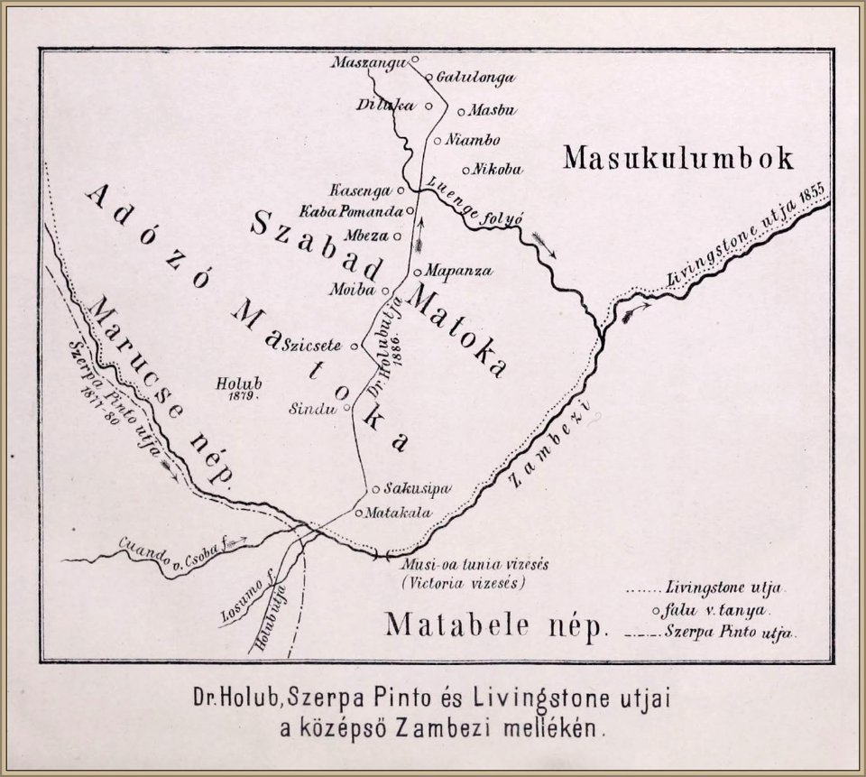
emil holub
wilhelm pleydenwurff
hartmann schedel
atlas van der hagen (volume 4)
atlas van der hagen
old maps of south africa
maps of the great trek
illustration
maps
1727 maps of africa
1720s maps of egypt
1727 maps of africa
1720s maps of egypt
maps of the dutch east india company - south africa
1747 maps
maps from the earth and its inhabitants, vol. x
old maps of africa
1870s maps of egypt
1879 maps of africa
historical
history
historical
history
a voyage to abyssinia, and travels into the interior of that country, executed under the orders of the british government in the years 1809 & 1810
john outhett
a class-book of modern geography (1898)
1890s maps of south africa
select views in india, drawn on the spot, in the years 1780, 1781, 1782, and 1783
british library asia, pacific and africa collections
maps in the rijksmuseum amsterdam
old maps of the ottoman empire
africa
maps
historical
history
historical
history
historical
history
a voyage to abyssinia, and travels into the interior of that country, executed under the orders of the british government in the years 1809 & 1810
john outhett
historical
history
a voyage to abyssinia, and travels into the interior of that country, executed under the orders of the british government in the years 1809 & 1810
john outhett
a voyage to abyssinia, and travels into the interior of that country, executed under the orders of the british government in the years 1809 & 1810
john outhett
navigantium atque itinerantium bibliotheca
1744 fleurons
maps by emanuel bowen
1744 fleurons
18th-century maps of antarctica
1741 maps
1650s maps of the americas
1658 maps
maps by joachim bormeester
1685 maps
brochure
draft
images released by british library images online, march 2014
british library asia, pacific and africa collections
historical
history
prints by jan luyken in the rijksmuseum amsterdam
old maps of africa
satirical prints in the british museum
francis jukes
201 - 239 of 239
/ 3